
Waterfront Living on Florida's Space Coast: A Neighborhood-by-Neighborhood Guide
Florida's Space Coast stretches along roughly 72 miles of Atlantic coastline in Brevard County [1], offering an unusually diverse range of waterfront settings — from open-ocean beachfront to sheltered river-view lots tucked inside the Indian River Lagoon system. If you're weighing waterfront options here, the differences between property types, flood exposure, and price points are significant. This guide breaks it all down.
The Four Waterways — and What Each Offers
Indian River Lagoon The Indian River Lagoon runs nearly the entire length of Brevard County, making it the backbone of Space Coast waterfront real estate. Properties along the lagoon range from single-family homes with private docks to mid-rise condominiums with panoramic water views. The lagoon is part of the most biodiverse estuary in North America [2], meaning manatee sightings, fishing off your own dock, and kayaking routes are everyday realities — not marketing copy. Riverfront lots here typically carry shallower water depths than Atlantic-facing properties, so dock construction and boat size are worth verifying before purchase.
Banana River The Banana River Lagoon sits between Merritt Island and the barrier island communities of Cocoa Beach and Cape Canaveral. It is a no-wake, idle-speed zone throughout [3], which keeps boat traffic calm and makes it a quieter waterfront setting than the open Intracoastal. Properties on the Banana River tend to offer direct views of Kennedy Space Center's launch pads — rocket launches visible from your backyard are a legitimate selling point unique to this stretch of Florida.
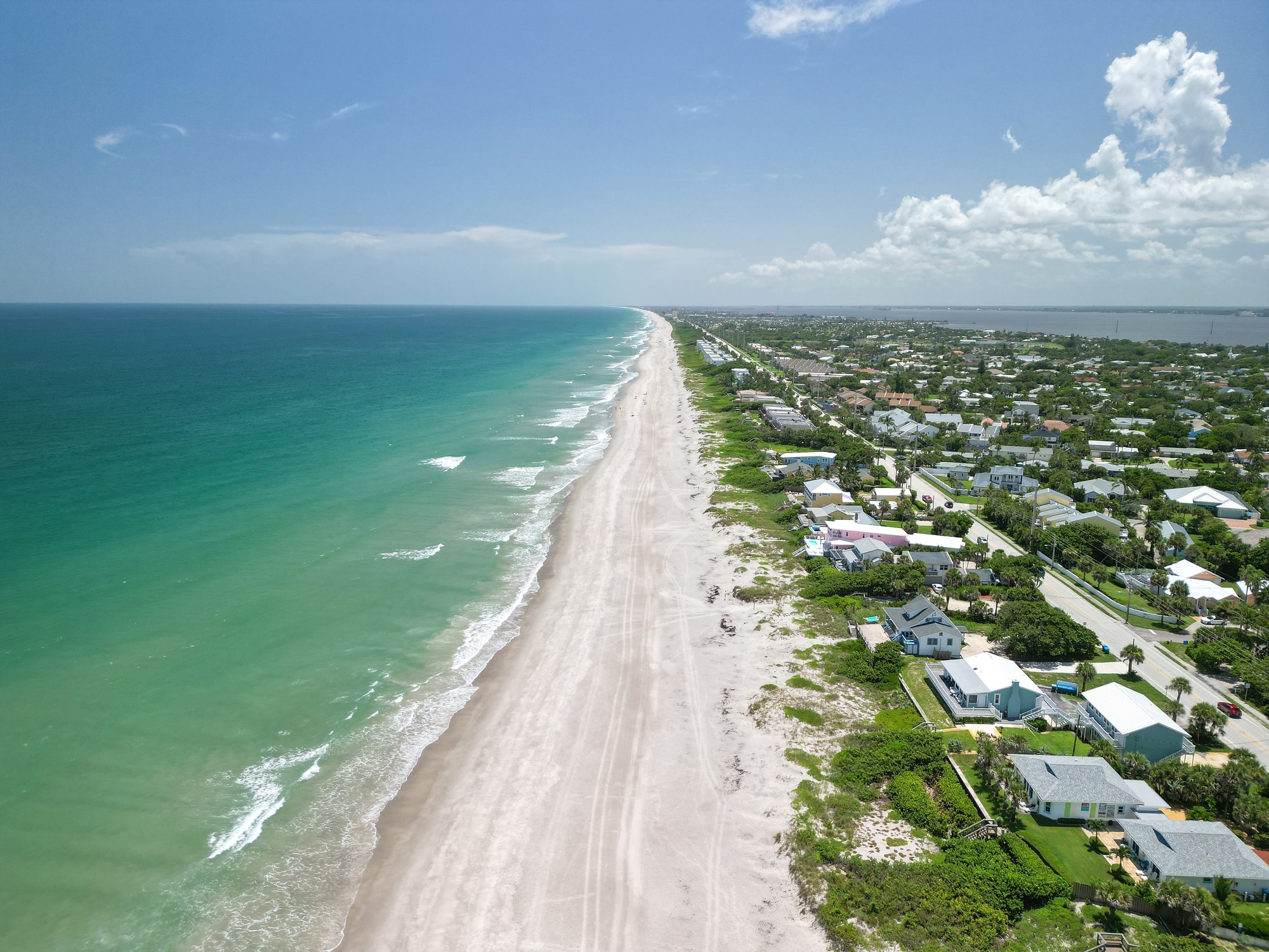
Atlantic Ocean Beachfront Direct oceanfront product — primarily condominiums and a smaller number of single-family homes — lines A1A through communities including Cocoa Beach, Satellite Beach, Indian Harbour Beach, Melbourne Beach, and Indialantic. These properties deliver unobstructed sunrise views, beach access steps from the door, and the highest price-per-square-foot of any waterfront category on the Space Coast. They also carry the greatest flood and wind exposure, a factor discussed in more detail below.
Intracoastal Waterway
The Intracoastal Waterway through Brevard functions as a boating corridor connecting the lagoon system to the broader Florida coast. Canal-access homes — particularly in areas like Rockledge, Merritt Island, and south Brevard — offer navigable water access and private dockage at price points that are often more accessible than direct riverfront or oceanfront listings.
Typical Price Ranges
Waterfront property commands a measurable premium. According to Florida Realtors data, waterfront homes statewide sell at a significant markup over comparable non-waterfront properties [4]. On the Space Coast specifically, direct oceanfront condominiums in Cocoa Beach and Satellite Beach have listed in a wide range, with beachfront units frequently appearing at $400,000 to well over $1 million depending on floor, finish, and square footage [5]. Indian River Lagoon riverfront single-family homes in communities like Eau Gallie and Indialantic have shown median list prices noticeably above the overall Brevard County median [5]. Canal-access homes on Merritt Island represent the most accessible entry point into navigable waterfront, with listings spanning from the mid-$400,000s upward depending on lot depth and dock configuration [5].
These ranges shift with inventory and rate conditions — MaxxCity's Space Coast MLS search lets you filter specifically by waterfront type to see current active listings.
Flood Zone Considerations
This is the section you cannot skip. FEMA designates flood zones based on estimated risk, and waterfront properties in Brevard County fall across multiple zone categories [6]. Direct oceanfront condominiums and beachfront homes frequently sit in FEMA Zone VE — the highest-risk category, indicating exposure to wave action in addition to flooding [6]. Indian River Lagoon and Banana River properties are commonly mapped in AE zones, which require flood insurance for federally backed mortgages [6]. Canal-access properties vary; some fall in AE zones, others in lower-risk X zones.
Flood insurance costs have shifted materially following FEMA's Risk Rating 2.0 methodology, introduced in 2021, which prices policies based on individual property characteristics rather than broad zone averages [7]. Before closing on any waterfront property, request the current Elevation Certificate and obtain a flood insurance quote — do not assume the seller's existing rate will transfer unchanged.
What Waterfront Living Actually Looks Like Day-to-Day
Beyond the investment conversation, the lifestyle case for Space Coast waterfront is straightforward. Brevard County averages approximately 236 sunny days per year [8], which means water access gets used regularly — not just on weekends. The Indian River Lagoon supports recreational fishing, paddleboarding, and dolphin-watching within minutes of most riverfront neighborhoods. Beachfront residents along A1A are within easy reach of surf breaks, sea turtle nesting habitat, and Canaveral National Seashore, which preserves 24 miles of undeveloped Atlantic coastline [9].
MaxxCity's neighborhood-level data makes it straightforward to compare specific streets, flood zone maps, and HOA amenity packages across Brevard's waterfront communities before you visit a single property.
Making the Right Match
Every waterfront category on the Space Coast involves trade-offs between price, flood exposure, water access, and lifestyle pace. Ocean-facing properties offer the most dramatic setting and the highest insurance complexity. Lagoon and river properties balance access with relative shelter. Canal homes offer navigable water at a lower entry cost. Understanding those distinctions — not just the view from the listing photos — is what turns a good waterfront purchase into the right one.
Sources
- [1]Brevard County Government — https://www.brevardcounty.us
- [2]Indian River Lagoon National Estuary Program — https://www.epa.gov/nep/indian-river-lagoon
- [3]Florida Fish and Wildlife Conservation Commission — https://myfwc.com
- [4]Florida Realtors — https://www.floridarealtors.org
- [5]Space Coast Association of Realtors / Space Coast MLS — https://www.spacecoastrealtors.com
- [6]FEMA Flood Map Service Center — https://msc.fema.gov
- [7]FEMA Risk Rating 2.0 — https://www.fema.gov/flood-insurance/risk-rating
- [8]National Oceanic and Atmospheric Administration (NOAA) — https://www.noaa.gov
- [9]Canaveral National Seashore, National Park Service — https://www.nps.gov/cana